
Mapping the Migration of Tennessee Revolutionary War Patriots
You have to check out this new map database from The Tennessee State Library and Archives: Patriot Paths – the migration paths of Tennessee Revolutionary War patriots. What an incredible compilation and visualization of data!!
What is today Nashville is the center of a 100-square-mile area of land that North Carolina designated a military district. Land from this area was given to soldiers as payment for their Revolutionary War service. By taking data from pension application papers and census records, the Tennessee State Library and Archives folks have mapped where most of the 1,200 Revolutionary veterans receiving a pension in Tennessee originally came from. This is truly an awesome effort.
A quick walk through
Here is a quick sort of walk through of some of the features that I checked out just this afternoon.
From the Patriot Selector tab, you can use the drop down on the right side to Select Soldier. If you’re not having luck typing in a name, you can scroll thru all of the available names in the list easily. I found a name that I’ve been research lately, so chose that for an example here – John Puckett. The picture below from the website shows his migration route from know records, from 1764 to 1832.
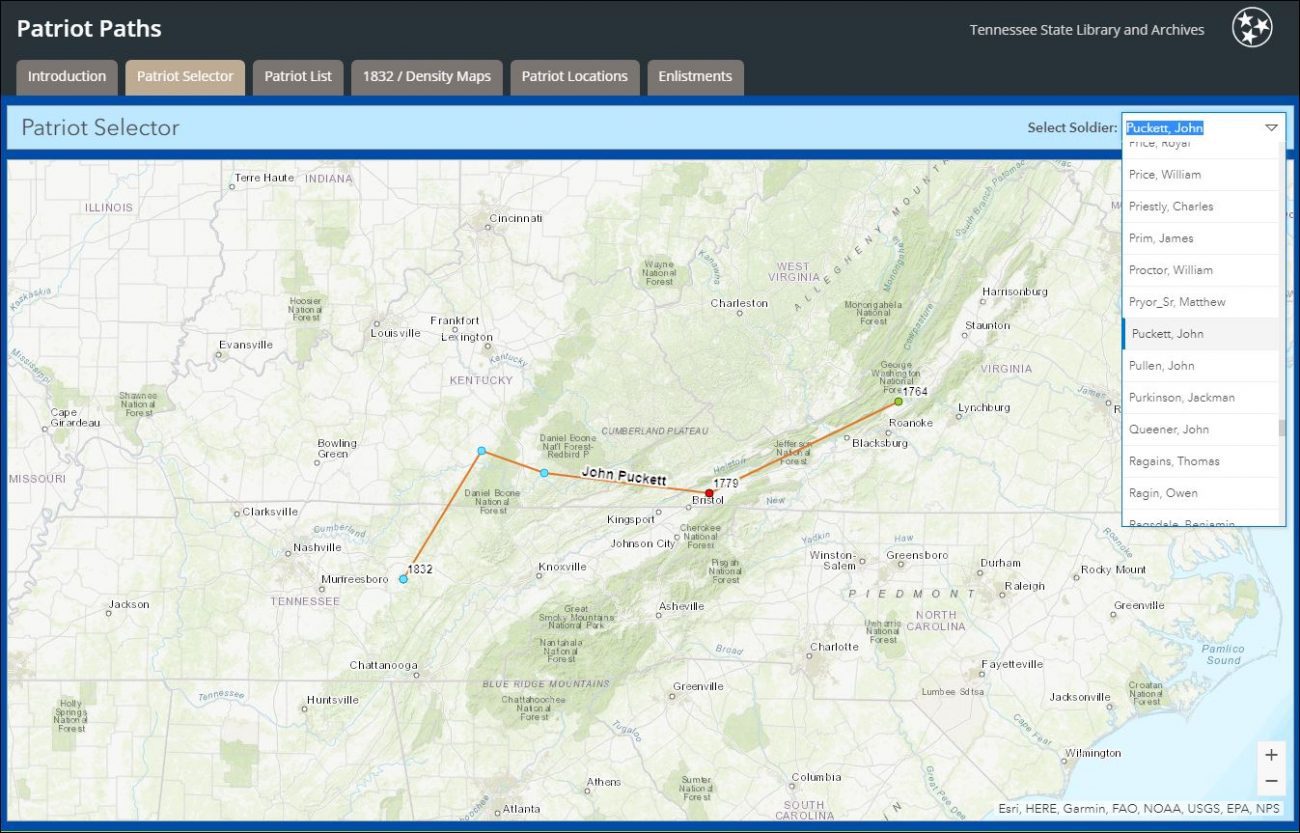
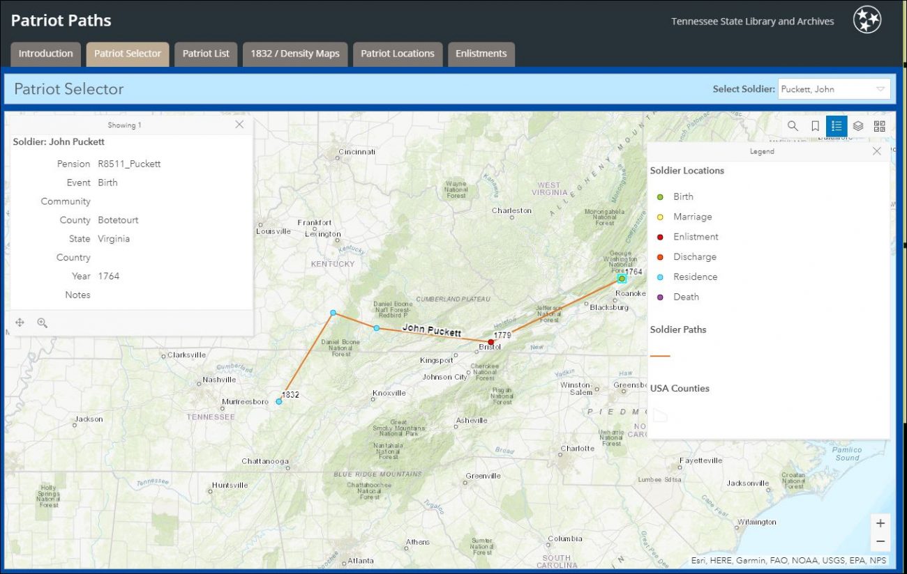
I love to see what all the buttons do, and found that the ‘list’ one is the legend for the colored dots on his migration path. And clicking on one of the buttons pops up the available information. I clicked on the first one, green, his birth.
I discovered I could zoom way in on the map to get a better idea of where he was born:
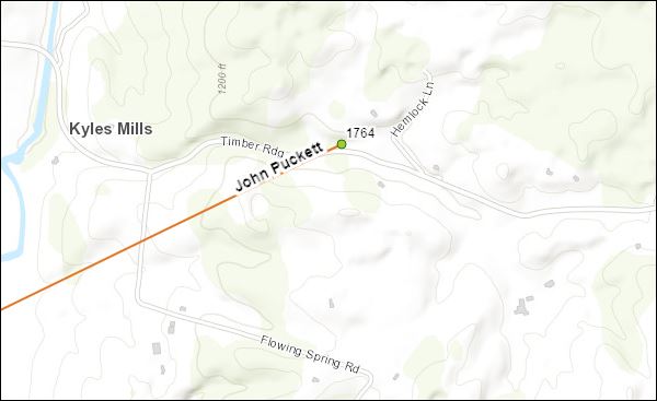
And better yet, I could choose “Imagery with Labels” from yet another button, zoom in, and see what that landscape actually looks like today! (Note to self: check to see if there may be a family cemetery somewhere in that area)

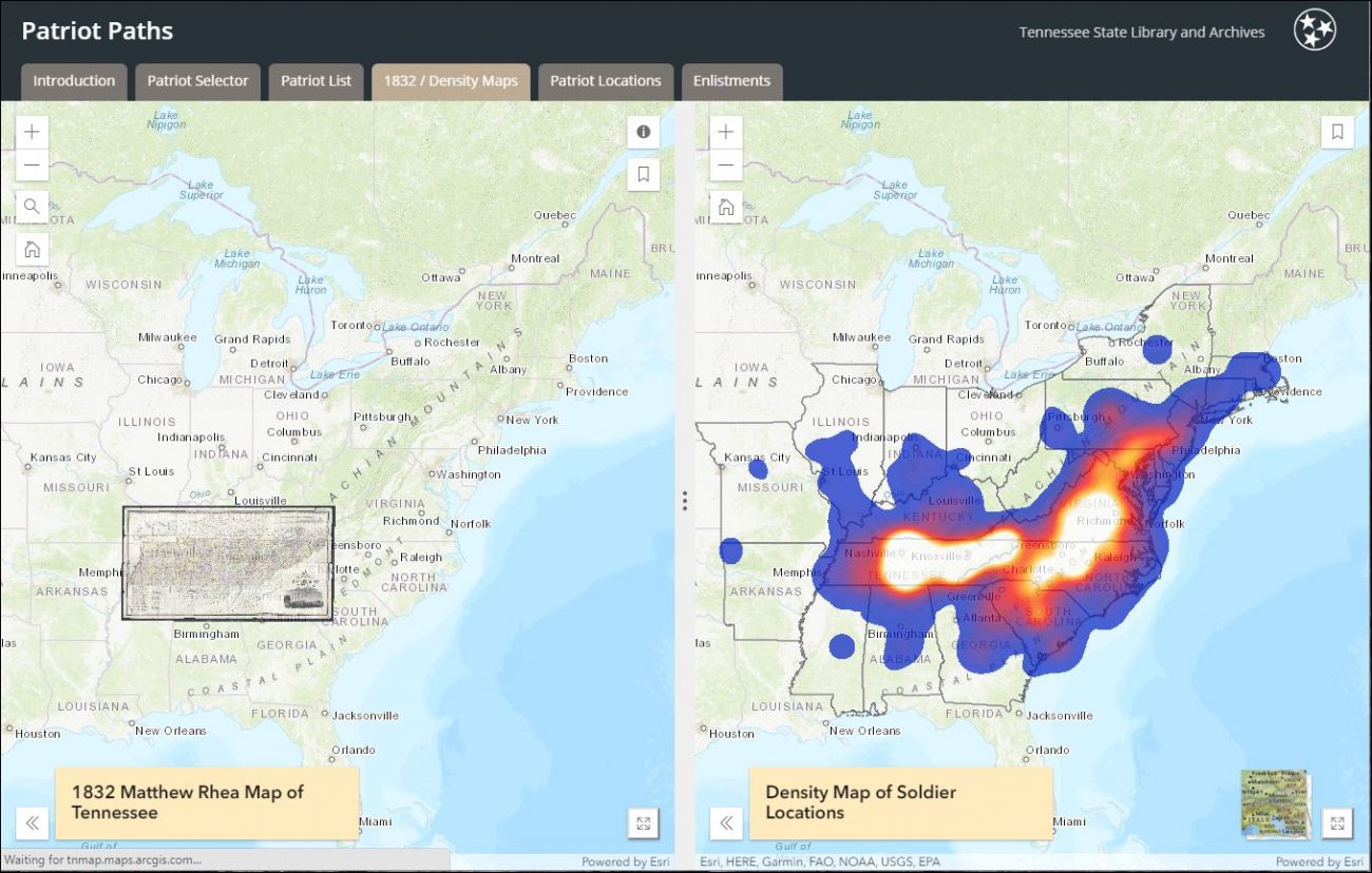
Another very cool view is the 1832/Density tab which shows, well, you guessed it, kind of a heat map of the density of soldiers living in Tennessee. If you’re a fan of FAN research (Friends, Ancestors, Neighbors), you’ll really appreciate this!
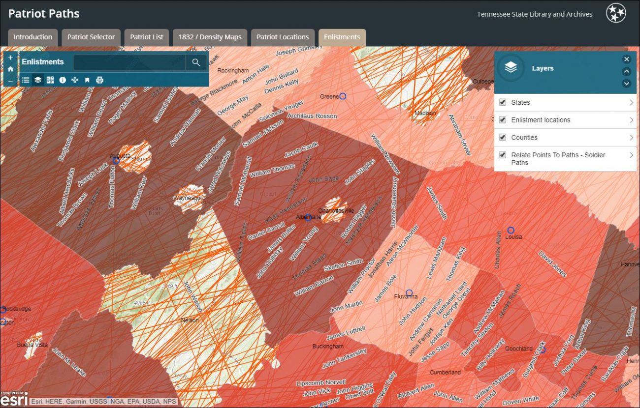
The last one I’m going to share here is the Enlistments tab, with Layers selected, as well as state and county lines, enlistment locations, and all migration paths and the names of the soldiers too!
So many, many, maps and options to explore, and I’m sure there will be more information added as time goes on.
You can read all about the project and data at the Patriot Paths website. And you can also find a detailed “instruction” booklet on the Patriot Paths: Tennessee’s Revolutionary War Veterans data at here.