
Enhancements to the Historical U.S. County Boundary Maps tool
It’s been a while since I last wrote about Randy Majors‘ Historical U.S. County Boundary Maps tool — a very handy interactive map that will show you the boundaries of any U.S. county based on the date that you choose. Not just every decade, or even every year — You choose a specific day and can see the boundaries on that exact date.
This handy map tool can solve some of your marriage issues. Okay, not really your marriage issues, but the problems you might be having locating courthouse documents such as a marriage record for your ancestors. Changes in county boundaries over the course of time may be the reason why your ancestor’s records aren’t in the courthouse that you think they should be. It’s possible that while a family may have owned the same piece of property for decades, the County lines may have been redrawn many times. Check this map out, and see what other nearby counties may also have records based on how close your folks lived to the courthouse…
Which brings me to another very awesome feature of this particular Historical US County Boundary Map: You can choose to overlay the location of Courthouses, Cemeteries, Churches, and Libraries! As you well know, cemeteries don’t tend to move around a lot, and courthouses often were the first major building of a new area and thus often didn’t change locations much either.
One of the new enhancements is a teeny tiny box that you might easily overlook. Located right above the “Go!” button by the date, clicking that box will enlarge the map to a much more readable and usable size. Be sure to use it!
How will this help my research?
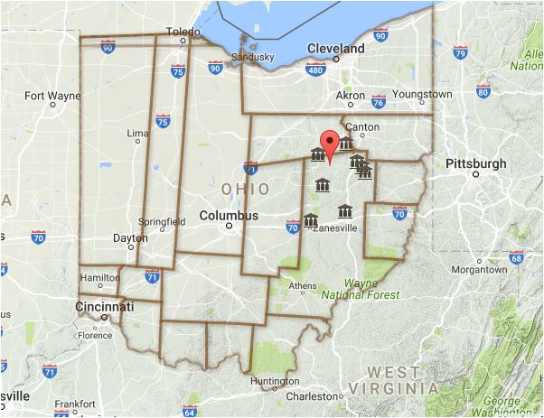
The value of knowing county boundary changes is illustrated in the two maps below. My ancestors arrived in Ohio before it was Ohio, and many still live there. Look at the difference in county boundaries between 1804 (left) and 1900 (right) in the screen captures below.
Be sure to add this to your list of genealogy tools, and set aside some time to spend trying out the map.
Ohio county boundaries 1804, from Historical US County Boundary Maps – http://www.randymajors.com/p/maps.html

Ohio county boundaries 1900, from Historical US County Boundary Maps – http://www.randymajors.com/p/maps.html