Finding historical aerial photographs online
I read an article yesterday about finding historical aerial maps (see the credit at the bottom), but felt it could use a little expanding with the actual “how tos”, so here’s my post.
Two highlighted program from the article are a lesser known Google Earth feature, “Historical Imagery” and a website that has aerial photos going back as far as 1920, HistoricalAerials.com !
To use the very cool Historical Imagery feature on Google Earth from your desktop, with the program open, go to the “View” drop down, and there it is – choose Historical Imagery. Once you’ve selected an address to view, a slider bar at the top will show you just how far back in time they have images that you can view. As far as I know, 1950 is their earliest.
Here are three photos from the last area in California that I lived, that went from being a dairy preserve to yet another sea of houses:

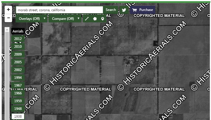
HistoricalAerials.com has images going back to 1920, but many of the images have their copyright very visibly displayed (an understatement). You can order individual digital photos without the copyright though, at a cost. Most addresses that I searched were both fairly great photos, and really easy to find my own and ancestral homes.
Here is a sample of the same location shown above from Google, on HistoricalAerials, from as early as 1938! Please note that the photos are copyrighted, they own them, I probably shouldn’t have used them, but I’m only showing this as an example so that y’all can go order lots of photos from their site. Please don’t hate me.

There ya go. Have some fun this weekend (As if you don’t already spend enough time online…)
Giving more credit where credit is due – my inspiration to write this came from: See what your house or land looked like 70 years ago – Library of Logic


Wuddayaknow – I didn’t know about the historical aerial views. I wonder if I will be able to find homes of my great-grandmother and her sisters in New York. Most seem to be a parking lot today.